U.S. Geological Survey Earthquake Hazards (USGS)
The U.S. Geological Survey Earthquake Hazards (USGS) integrationIntegrations connect and integrate Home Assistant with your devices, services, and more. [Learn more] lets you integrate a GeoJSON feed provided by the U.S. Geological Survey with information about seismic events like earthquakes. It retrieves incidents from a feed and shows information of those incidents filtered by distance to Home Assistant’s location.
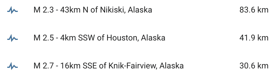
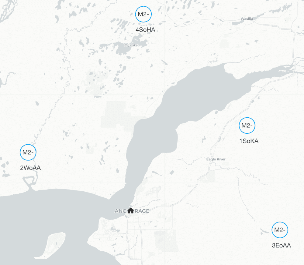
Entities are generated, updated and removed automatically with each update from the feed. Each entityAn entity represents a sensor, actor, or function in Home Assistant. Entities are used to monitor physical properties or to control other entities. An entity is usually part of a device or a service. [Learn more] defines latitude and longitude and will be shown on the map automatically. The distance in kilometers is available as the state of each entityAn entity represents a sensor, actor, or function in Home Assistant. Entities are used to monitor physical properties or to control other entities. An entity is usually part of a device or a service. [Learn more].
The data is updated every 5 minutes.
Configuration
To integrate the U.S. Geological Survey Earthquake Hazards Program feed, add the following lines to your configuration.yamlThe configuration.yaml file is the main configuration file for Home Assistant. It lists the integrations to be loaded and their specific configurations. In some cases, the configuration needs to be edited manually directly in the configuration.yaml file. Most integrations can be configured in the UI. [Learn more] file.
After changing the configuration.yamlThe configuration.yaml file is the main configuration file for Home Assistant. It lists the integrations to be loaded and their specific configurations. In some cases, the configuration needs to be edited manually directly in the configuration.yaml file. Most integrations can be configured in the UI. [Learn more] file, restart Home Assistant to apply the changes. The integration is now shown on the integrations page under Settings > Devices & services. Its entities are listed on the integration card itself and on the Entities tab.
# Example configuration.yaml entry
geo_location:
  - platform: usgs_earthquakes_feed
    feed_type: "past_day_all_earthquakes"
Configuration Variables
The U.S. Geological Survey Earthquake Hazards Program provides 20 feeds covering different timeframes and magnitudes. You must select one of the feed types listed below.
The minimum magnitude of an earthquake to be included.
The distance in kilometers around Home Assistant’s coordinates in which seismic events are included.
Latitude of the coordinates around which events are considered.
Latitude defined in your configuration.yaml
Supported feed types
| Description | Feed Type |
|---|---|
| Past Hour - Significant Earthquakes | past_hour_significant_earthquakes |
| Past Hour - M4.5+ Earthquakes | past_hour_m45_earthquakes |
| Past Hour - M2.5+ Earthquakes | past_hour_m25_earthquakes |
| Past Hour - M1.0+ Earthquakes | past_hour_m10_earthquakes |
| Past Hour - All Earthquakes | past_hour_all_earthquakes |
| Past Day - Significant Earthquakes | past_day_significant_earthquakes |
| Past Day - M4.5+ Earthquakes | past_day_m45_earthquakes |
| Past Day - M2.5+ Earthquakes | past_day_m25_earthquakes |
| Past Day - M1.0+ Earthquakes | past_day_m10_earthquakes |
| Past Day - All Earthquakes | past_day_all_earthquakes |
| Past 7 Days - Significant Earthquakes | past_week_significant_earthquakes |
| Past 7 Days - M4.5+ Earthquakes | past_week_m45_earthquakes |
| Past 7 Days - M2.5+ Earthquakes | past_week_m25_earthquakes |
| Past 7 Days - M1.0+ Earthquakes | past_week_m10_earthquakes |
| Past 7 Days - All Earthquakes | past_week_all_earthquakes |
| Past 30 Days - Significant Earthquakes | past_month_significant_earthquakes |
| Past 30 Days - M4.5+ Earthquakes | past_month_m45_earthquakes |
| Past 30 Days - M2.5+ Earthquakes | past_month_m25_earthquakes |
| Past 30 Days - M1.0+ Earthquakes | past_month_m10_earthquakes |
| Past 30 Days - All Earthquakes | past_month_all_earthquakes |
State attributes
The following state attributes are available for each entityAn entity represents a sensor, actor, or function in Home Assistant. Entities are used to monitor physical properties or to control other entities. An entity is usually part of a device or a service. [Learn more] in addition to the standard ones:
| Attribute | Description |
|---|---|
| latitude | Latitude of the earthquake. |
| longitude | Longitude of the earthquake. |
| source |
usgs_earthquakes_feed to be used in conjunction with geo_location automation trigger. |
| external_id | The external ID used in the feed to identify the earthquake in the feed. |
| place | Textual description of named geographic region near to the event. |
| magnitude | Reported magnitude of the earthquake. |
| time | Date and time when this event occurred. |
| updated | Date and time when this event was most recently updated. |
| status | Indicates whether the event has been reviewed by a human: “automatic”, “reviewed”, “deleted” |
| type | Type of seismic event: “earthquake” or “quarry”. |
Full configuration
# Example configuration.yaml entry
geo_location:
  - platform: usgs_earthquakes_feed
    feed_type: "past_month_all_earthquakes"
    radius: 50
    minimum_magnitude: 0.0
    latitude: 35.899722
    longitude: -120.432778
Card example
Assuming you configure this service using feed_type: past_week_all_earthquakes, you can create a corresponding map card in a dashboard with the following card:
type: map
geo_location_sources:
  - usgs_earthquakes_feed
entities:
  - zone.home
title: Nearby Earthquakes Last Week